Monday, 25 September 2023

Yellowstone River and Mud Volcano


We shifted our focus and continued following the winding Yellowstone River as it flowed upstream from Yellowstone Lake to the canyon. This led us into the expansive Hayden Valley, a broad floodplain that serves as a vital ecosystem.

The morning air remained crisp and chilly, causing steam to rise dramatically from the river’s surface. This ethereal effect was created by the blend of cold freshwater and warm geothermal inflows.

The Canada Geese appeared to be relishing the warmth of the geothermal-heated waters, leisurely paddling through the steam as they foraged for food hidden just below the surface.

As we continued tracing the path of the Yellowstone River upstream, we noticed numerous steam plumes rising unexpectedly from the landscape. Some emerged near the riverbank, while others billowed from deep within forested areas, highlighting the hidden geothermal activity scattered throughout the region. Just before rounding the bend into the Mud Volcano area, we spotted a massive plume of steam rising into the air, a striking sign that we were approaching one of Yellowstone’s more volatile geothermal zones.

The Mud Volcano area boasts a collection of intriguing geothermal features, all easily explored along a gentle one-kilometre loop trail. Informational boards at each stop provide fascinating insights into the unique characteristics and science behind every bubbling pool, steaming vent, and acidic mud pot.

Mud Caldron is a broad, shallow, and constantly steaming thermal pool that dominates the landscape right beside the parking area. Its churning, muddy waters immediately draw attention, setting the tone for the otherworldly geothermal sights to come.

Once the star attraction of the Mud Volcano area, Mud Geyser (above) was known for hurling mud up to 17 meters into the air. However, during the 20th century, its vent system became clogged with mud and gravel, bringing its dramatic eruptions to a halt. In recent years, though, signs of geothermal activity have gradually returned to the site.

Farther up the hill lies Churning Caldron, a large and active hot spring famous for its constantly bubbling, roiling waters. Despite its intense appearance, the agitation is not from boiling but from gases rising through underground vents, creating a dramatic and turbulent surface.


At the farthest point along the trail lies Black Dragon’s Caldron—a large, muddy, bubbling pool that, while more subdued than the energetic Churning Caldron, is significantly larger in size. This geothermal feature made a dramatic entrance in 1948 when it erupted through a fissure in the earth, splattering thick mud and toppling nearby trees.


Dotting the surface of Black Dragon’s Caldron are peculiar muddy bubbles, slowly rising and bursting.

Today, its waters flow into the adjacent Sour Lake (background).


This feature is the namesake of the entire area—Mud Volcano. Despite its dramatic title, it bears little resemblance to a traditional volcano. Instead, it resembles a churning, steaming mud pot.


Easily the most striking feature in the Mud Volcano area is Dragon’s Mouth Spring. Its name couldn't be more fitting—the dark, yawning cave seems to consume light, while bursts of steam erupt from within, sputtering like a dragon with a cough.


Mud Volcano marked our first real encounter with Yellowstone’s geothermal wonders—an unexpected surprise, as we hadn’t anticipated seeing any geothermal activity until later in the trip when we planned to explore the western side of the vast caldera.


We followed the Yellowstone River upstream until arriving at Fisherman’s Bridge, situated at the river’s origin where it emerges from the vast expanse of Yellowstone Lake. This tranquil location signifies the shift from the calm waters of one of North America's largest high-altitude lakes to the steadily intensifying current of the Yellowstone River.


As Yellowstone Lake overflows, the excess water flows through a gentle, eroded stretch of the surrounding hills, forming the expansive upper section of the Yellowstone River. This broad area serves as a vital habitat, rich with native cutthroat trout.


From Fisherman’s Bridge, your gaze naturally follows the river mouth and across Yellowstone Lake, eventually drifting toward the distant silhouette of the majestic Grand Tetons rising on the horizon.


We followed the road that loops through Lake Shore Village, making our way to the General Store—only to find it closed for the season, putting an end to our hopes of grabbing lunch. Despite that minor letdown, we had the place entirely to ourselves. The lake stretched out endlessly, blending seamlessly into the sky, creating a tranquil, almost surreal scene.


We made our way back to Canyon Village for lunch break before we return to the Canyon.

Grand Canyon of Yellowstone (morning)


True to our usual routine, we rose early and set out to stay ahead of the crowds. Our day began at the Grand Canyon of the Yellowstone—a strikingly deep and narrow gorge that, while smaller than the famed Grand Canyon, is no less captivating.

Pictured above is Lower Falls, a spectacular cascade that is the largest waterfall in the Rocky Mountains of the United States, with a height of 94 metres. It was formed by the Yellowstone River flowing over resistant volcanic rock.

Below the Lower Falls, the powerful Yellowstone River carves a deep path through the sandstone canyon, its currents fierce and unrelenting.

We spotted a squirrel with an impressively bushy tail, darting around in typical squirrel fashion, nervously clutching a nut in its mouth as it scouted for the perfect hiding spot. Much of the canyon and part of the waterfall were cast in shadow, so we decided to return later in the day when the lighting would be more ideal for viewing and photography.

Yellowstone North Entrance and Mammoth Hot Springs


We finally made it to Yellowstone! And the sign proves it.


Entering the park through the iconic Roosevelt Arch, a towering stone gateway steeped in history, set the perfect tone for this leg of the trip.


Just beyond the entrance, we were thrilled to spot a small herd of Pronghorns, the only species of antelope native to North America, grazing peacefully in the open fields.


We continued to Fort Yellowstone, only a few kilometres inside the park gate. This site serves as both the historic and present-day administrative center of Yellowstone National Park and features a well-equipped visitor center that offers valuable insights into the park’s history and operations. The layout of Fort Yellowstone is that of a typical western army post.


Nearby lies the natural wonder, Mammoth Hot Springs, known for its striking travertine (calcium carbonate) terraces formed by mineral-laden hot water rising from underground. The photo above captures the Lower Terrace, which is essentially the bottom step of the natural staircase.


Next to the Lower Terrace stands the Liberty Cap (above), a dormant hot spring deposit, formed by travertine deposition over time as hot water cooled and mineral deposits accumulated.


On the Lower Terrace, a group of elk was resting peacefully, while the dominant bull elk roamed the perimeter, bugling loudly to ward off any rival males and protect his harem.


Eventually, the herd wandered off, likely in search of fresh vegetation to graze on.


As the elk herd moved on, so did we, mindful that daylight was fading and we still had about 50 kilometers to cover before reaching Canyon Village.


Along the way, we made an unplanned stop at Tower Junction after spotting our first bison herd, calmly grazing near the roadside.


We also took a brief detour to admire Tower Fall—a stunning 40-metre waterfall framed by tall, narrow rock spires.


We were fortunate to catch sight of a mountain sheep skillfully navigating the steep slopes high above the waterfall. By this time, night was beginning to fall, and we still had around 25 kilometers to cover, including the winding, high-altitude stretch through Dunraven Pass. We reached Canyon Village just as dusk settled in—just in time to check in, get settled, and enjoy a well-earned meal at the Canyon Eatery.

Seattle exit. Success! The path to Yellowstone.


With yesterday’s travel fiasco behind us, we packed up in no time—mainly because most of our belongings were already waiting for us in Bozeman. The weather had taken a turn for the worse; it wasn’t just raining—it was downright cold, making it feel like winter was closing in. Determined not to repeat the chaos of yesterday, we arrived at the airport early, giving ourselves more than enough time to breeze through security, which was thankfully much calmer today. We even had time to grab a proper breakfast inside the terminal.

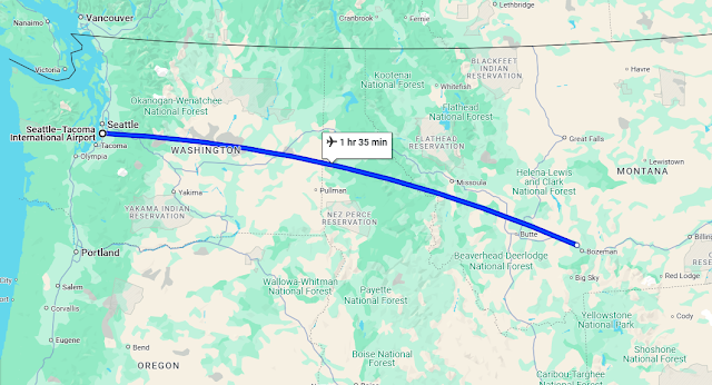
As the plane lifted off toward Bozeman, a wave of relief and excitement washed over us, finally, we were back on track and ready to continue our adventure. Bozeman is one of three main airports providing access to Yellowstone National Park. Compared to the alternatives—Jackson Hole and West Yellowstone—Bozeman is the more practical choice. The other two typically involve two connecting flights and can take up the better part of a day, not to mention they tend to be significantly more expensive.

We touched down in Bozeman just after midday local time, and it felt great to be back in Big Sky Country after more than a decade. I’m not usually one to praise airports, but Bozeman is a clear exception. With its stunning architecture and warm, log cabin-inspired timber design, it creates an immediate sense of welcome. The skies were clear, and we were thrilled to finally be on our way to Yellowstone National Park.

We had a bit of a delay at the airport sorting out our luggage, which had been held overnight since our missed flight. Once we tracked it down, we joined the queue to pick up our rental car—another small wait before we could finally hit the road. Kerri got her first real experience driving on the "right" (or as she joked, the wrong) side of the road, which made for some fun commentary. Before leaving Bozeman, we swung by a supermarket to stock up on essentials and grab some lunch.

Then it was off on the scenic hour-and-a-half drive toward the gateway village of Gardiner and the North Entrance of Yellowstone National Park.

Montana earns its nickname “Big Sky Country” for good reason—the vast open plains stretch endlessly beneath a sweeping blue sky. As we headed south, the landscape shifted dramatically, giving way to striking, snow-capped mountain ranges.


After leaving the wide lanes of Interstate 90 at Livingston and merging onto Highway 89, the towering peaks began to close in around us. With late autumn settling in, some trees had already started to turn, their leaves adding bursts of colour under the soft, golden sunlight. 

We finally arrived in Gardiner—24 hours later than originally planned. Our itinerary had us staying in the village the night before, which would have given us the full day to explore the northern reaches of Yellowstone en route to Canyon Village. Unfortunately, with the delay, we are left with just a few hours to squeeze in a couple of quick stops before needing to reach our hotel before nightfall.