We woke up the next morning in our little cabin to -15C! Ouch! The 2100m above sea level in the middle of winter tends to make for some low temperatures.
After breakfast we had a bit of a look at a couple of view points near the village & took a few photos.
I soon learned to use the camera with gloves on.
Yavapai Point
Yaki Point
Helicopter Flight
We had booked a helicopter flight for 11am & headed off for the airport. It was the first time I'd (we'd) been in a helicopter so it was all very exciting. Notice the large "Vista" windows in the aircraft. It turned out to be a great advantage when looking down into the canyon. The 50min flight cost about $180CAD all up & as well worth it (I would almost call it a steal).
The first part of the flight traveled across the forest to the Canyon Rim. The Grand Canyon National Park forests are different to any that I've ever seen before. The trees are all so much shorter than the tall forests of Alberta. The trees all seem stunted & are quite well spread apart. It means that the light comes through to the ground easily & reflects off the snow. It's hard to take a photo of, but believe me, its worth seeing, particularly from the ground.
This is about the best view of the Colorado river we had & I can't tell you how awesome it was to see it from the air. This photo was taken from the North East section of the main part of the Grand Canyon.
One thing you notice from the helicopter more than by driving, is the variety of geological formations in the Grand Canyon.
This ridge caught my attention & kind of reminded me of a dinosaur.
This is one of a number of similar sharp peaks in the canyon. This is Mt Hayden & can be seen from the North Rim by road. The North rim is actually closed to cars in winter as the roads are snowed over.
Here's Mt Hayden from a different aspect. Again, I can't stress how awesome the view is from the helicopter.
The snow made for a nice touch & looked like someone had sprinkled the Canyon with icing sugar. It showed up the layers & ridges nicely.
This peculiar formation is called Brady Peak, also known as The Battleship.
Desert View
After our thrilling helicopter ride, we headed along the Eastern Rim
road out to a place they call Desert View. Some years ago the Americans
(in their infinite wisdom) built this replica Indian watch tower. A
clever plan since it is really an excuse for a merchandising store /
tourist trap.
In the end, it's built on my vote for the best view of the
canyon on the South rim.
Lipan Point
Remember the watch tower? Well that's it just right of centre of
picture, perched up on the ridge. It really puts the incredible size
& depth of the Grand Canyon into context.
View Point
Grandview Point
Thanks to the high altitude (2000m above sea level) & the lack of mountains near by, the trees get hammered by high winds & cold air. On top of that the lack of oxygen makes for a fairly hostile climate for plant life. Consequently the trees are typically short & twisted like this one, particularly where they're exposed to the winds from the canyon.
Grandview point is one of the more trafficked view points on the South Rim. Not bad, but I preferred Desert View.
This is just one of those Rim viewpoints, but I quite liked it. I managed to get my camera & tripod to play the game as well & the result speaks for itself. This photo has been stitched from two photos.
This rock formation was popular with the resident crow. I call it 'Bird's View Point'. From it's perch, the crow could overlook the Grand Canyon to the rear & keep an eye on humans bringing potential snacks to the front. There were many other similar stop points with wonderful views of the Grand Canyon.
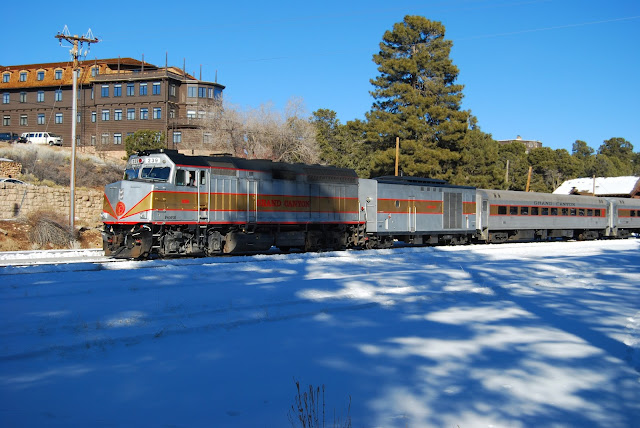
Grand Canyon Railway
No trip to anywhere in North America is complete without the obligatory train shots.
There are a small number of passenger trains to the Grand Canyon that run from Williams (the hicksville town 90 miles to the south of the Grand Canyon) & Flagstaff. There's even a steam train that runs from Williams sometimes.


