Sunday, 20 January 2019

Stanley and The Nut


Port Latta


This morning we got going early to beat the heat. Today we'd be tracking along the north west coast to one of the mpre famous table top capes, The Nut, along with the historic town of Stanley that shrouds the base of the long extinct volcano.

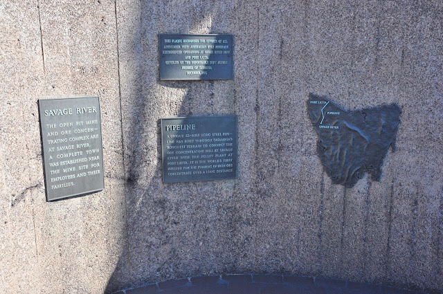
As we tracked along the coast, we stopped every now and then to enjoy the views back toward Rocky Cape and Table Cape (above). About 20km short of Stanley, we were surprised to find a very long jetty, of all things. As it turns out, Port Latta is home to an iron ore ship loading terminal.

The iron ore is mined near Savage River some 42 kms to the south and piped to the port. Western Tasmania was the last place I expected to find an iron ore mine.

We caught our first good look at the Nut while we were checking out the port.


During one of our photo stops, we left the car unnattended for a moment. Sure enough the crazy rally driver was in the driver's seat as quick as a flash!

Stanley & The Nut

The Nut is one of the better known bluffs dotted along Tasmania's north coast. The steep sides of the 143m high extinct volcano are quite dawnting when you are standing at it's foot. There are two ways to reach the flat top.

1. The easy way. Take the chairlift.


2. The hard way. Walk up the steep zig-zag trail.

Stubbornly, we opted for the hard way. I'm going to say that the challenge of the climb was the driving factor. The reality was probably more finacial.

Fortunately, the reward for effort is significant. The unobstructed views from the circuit trail around the rim of the knoll are breathtaking.


There werre plenty of things to see as we made our way around the circuit.


We encountered abundant wildlife including a blue tounged lizard and a family of show-off fairy wrens.


Just as we were admiring the last of the spectacular scenery before decending into Stanley, one more creature decided to impress us with a flying display.

This Autralian Kestrel was hovering completely still in the face of a considerable breeze.

Truth be told, we found decending the steep zig-zag trail more difficult than the climb.

We didn't stop in Stanley itself. There wasn't much of a draw and we had lots still to do.

We did make one stop at the lookout point on the top of the hill that overlooks Stanley before moving on to our next attraction.

The Town of Penguin


The drive from Devenport to Sisters Beach didn't have much of interest other than the route running along the coast from village to village.

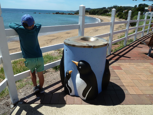
We were seemingly hopping from small coastal town to town. Our lunch stop was in the town of Penguin. There is a healthy penguin population that have nests along the local coastline. The towns folk have almost everything penguin themed. Statues (above), street furniture (below),...

Even rubbish bins.

Mysteriously, we didn't see any real penguins.

We eventually reached Sisters Beach late in the afternoon. By then, the temperature was in the high 30s! We had a quick drive around to get the lie of the land. ending up at Rocky Point (below).


The heat was too much, so it was swim time at Sisters Beach. Lost of people were swimming the the stream, but we thought better of it and made the effort to traverse the wide beach and swim in Bass Straight instead. There was just enough of a wave to teach Harry some of the basics of body surfing.


Saturday, 19 January 2019

Don River Railway.


Today we were on the move again but we did have one activity planned before leaving Devenport for Sisters Beach.

Devenport is home to the Don River Railway. The historic railway is stacked with a wide range of locomotives & rolling stock from the steam age, through to more more recent times of the deisel age.


Harry's favourite was the Y-Class loco (above). He was most put out that it wouldn't be pulling our train today.


The Railway has a sizable workshop where the visitors can observe the volenteers repairing & resorting the trains.

Steam train journey.


The Don River Railway isn't just a static display. Most of the locos & rolling stock are still active, albeit as a tourist train. We were fortunate enough (depending on perspective) to be there on the one day a month that they were running the M-Class Steam Locomotive with the tourist train. Harry isn't a fan of "Stinky steamies" and wanted the Y-Class to be doing a proper job of it.


Mum was much more excited having caught a steam train to school back in the day.


All Aboard!

Before we knew it, we were off on the 30 minute journey alongside the river toward the coast. The original railway once ran all the way to Burnie, but the first few kilometres from the museum are all that remains in use today.


The M-Class is no little dinky toy. It is a prober heavy duty stream locomotive. Although the time for the technology for these old relics has long passed, it is difficult to look past the engineering & mechanics of these amazing pieces of machinery.


The loco pulled the train in reverse on the outbound leg & had to decouple and swicth ends at the terminus. It gave us a chance to hop out of the train & watch it in motion at close range.


We were delivered back to the museum safely. With another activity box ticked, we were on our way to Sisters Beach on the Bass Straight coast.

Devenport Ferries

Our caravan park in East Devenport was located right at the rivermouth where the Spirit of Tasmania departs for Melbourne. With departure information at hand, we set off to the river hoping to see the famous ferry make it's way out into Bass Straight. Our first impressions of the ferry were a bit underwhelming (above). We quickly we realised that this was in fact the Spirit of Devenport, a small cross river ferry.

The huge Spirit of Tasmania cruised past us right on time. Mersey River is fairly narrow, so the size of the huge ferry is quite daunting when you are so close.


Before we knew it, the Spirit was out of the river and into Bass Straight for the overnight voyage to Melbourne.

Friday, 18 January 2019

Cradle Valley

Mount Roland

Cradle Valley was earmarked as one of the highlights when we were planning the trip and today was the day to explore it. We set off early as there was a long drive to ge there and we wanted to beat the crowds. As we tracked south the escarpment of the central plateau came into view in the form of Mount Roland.

Dove Lake


The weather was overcast, windy and a bit cooler than we had expected. Having checked in at the visitor centre, we caught the shuttle bus to Dove Lake (above).


The majority of tourists walk part the way around Dove lake or the full circuit and that is the limit of their Cradle Valley visit. Considering that Cradle Mountain towers over the lake, that you have seen some of the best that the valley has to offer. However, our plan was to venture beyond Dove Lake and hike up to Crater Lake. After a short distance around the lake, we veered away from the lake and up hill.
Some clever cloggs altered pretty much every sign pointing to Wombat Pool (above).


As we climbed, we kept glancing behind us to look at the saddle of Cradle Mountain (above), still towering above us.

Lake Lilla


The trail up to Crater Lake passes two other water features beginning with Lake Lilla (above). The lakes in the area are all black thanks to the numerous tea trees that leach sap into the ground water.


The trail started to go more vertical after Lake Lilla via boardwalk steps. The boardwalks have been added to the trails to reduce the spread of dieback (a fungus that kills vegetation) and to reduce damage and erosion to the trail by the huge number of visitors each year.

Wombat Pool


As expected, Wombat Pool was void of wombats because that's what happens when you name a geographic feature with an animal name. It scares them away! This is a known worldwide phenomenon. Wombat Pool was interesting, despite the lack of wombats. Once again the dark stain tint in the water was prominent.

The trail got even steeper as we turned up the ridge above Wombat pool. The boardwalks also vanished, turning it into a scramble of sorts with loose rocks. We had just connected with with the Overland Track that starts at Ronney Creek shuttle stop. As we gained elevation we found ourselves more & more exposed to the howling wind.


By the time the trail leveled off above Wombat pool (below) we had unobstructed views down the Ronney Creek Valley and the shuttle stop we would descend to later.

Dove Lake / Crater Lake Lookout

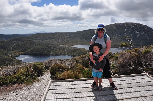
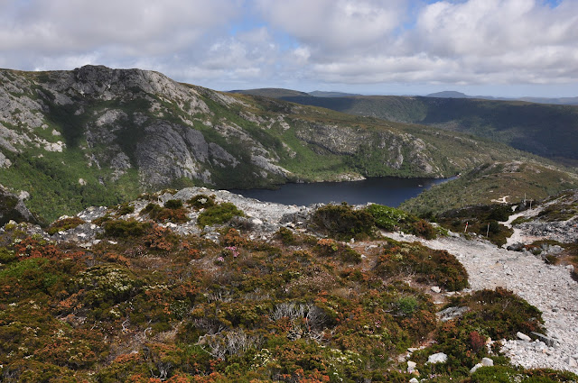
We all made it to the lookout on the top of the ridge fatigued, but otherwise unscathed. On the eastern side Dove Lake & Lake Lilla were far below us. To the west, Crater Lake has a backdrop of a steep rocky ridge.

Marions Lookout

The team were keen to head back down the valley but I wasn't satisfied with the lake lookout. My mission was to complete the next section of the Overland Track as far as Marions Lookout. After a fairly sedate walk along the ridge (left of the above picture) the trail suddenly turned much more vertical. The previous scramble seemed like a doddle compared to this. I was finding to challenging with a day pack and a camera bag. There were others with full hiking packs that I was certain were going to topple backward and find themselves back on the ridge in pieces.

The views of Crater Lake became increasingly impressive. The origins of its name became more obvious the further up the steep slope I climbed.


I was in a world of hurt by the time I reached the lookout. I was under time pressure to make the lookout & descend in time to catch the others so I was charging pretty hard on difficult terrain. The effort was worth it though, and I wanted to soak in the spectacular views.

Finally I had a clear view of Cradle Mountain. I felt like it was drawing me to hike over to it, but that will have to wait for another time. Dove Lake seems so far below. Had we really climbed that much in the space of a couple of hours?

The lookout is high enough that you can look east across the central plateau and notice that it isn't as flat as you would expect. It is some of the inaccessible wilderness that Tasmania is famous for. From the lookout, it felt like you could just reach up and touch the underside of the clouds. Maybe if I was another foot taller.....

Crater Lake

The scramble back down to Crater Lake was even more challenging than the climb. I made it without incident but there were quiet a few near misses.

I followed the trail off the side of the ridge at the Lake Lookout and followed Carter Lake's shoreline. Down there is was protected from the wind which was a nice reprieve and I could enjoy the scenery in some level of comfort.


Crater Lake overflows via an obscure little stream that vanishes under a log (above).

Ronney Creek

The creek reappears a little way down the valley and topples over a rocky shelf forming the twin waterfalls called Crater Falls. This is the headwaters of Ronney Creek.


Ronney Creek initially meanders through the forest before the forest gives way to a vast marshy  grassland. This was where I managed to catch up to the rest of the party.

We were very lucky to see a wombat munching away on the lush grass. The poor critter was being harassed by a hoard of march flies.

We caught the shuttle back to the visitor centre and had a picnic lunch in the back of the car. We didn't have time or the energy to go back out and try to tackle another trail. I suspect we'll be back at some point to explore this area more thoroughly. I'd like to take on the overland track some day.

We decided to take the alternate, slightly longer, roads back the Devonport. We did start to question our judgement a bit when we saw signs like the one above. The road took us past the Cethana Dam(below). There isn't anything especially remarkable about it.