Monday 21 January 2019

Dip Falls


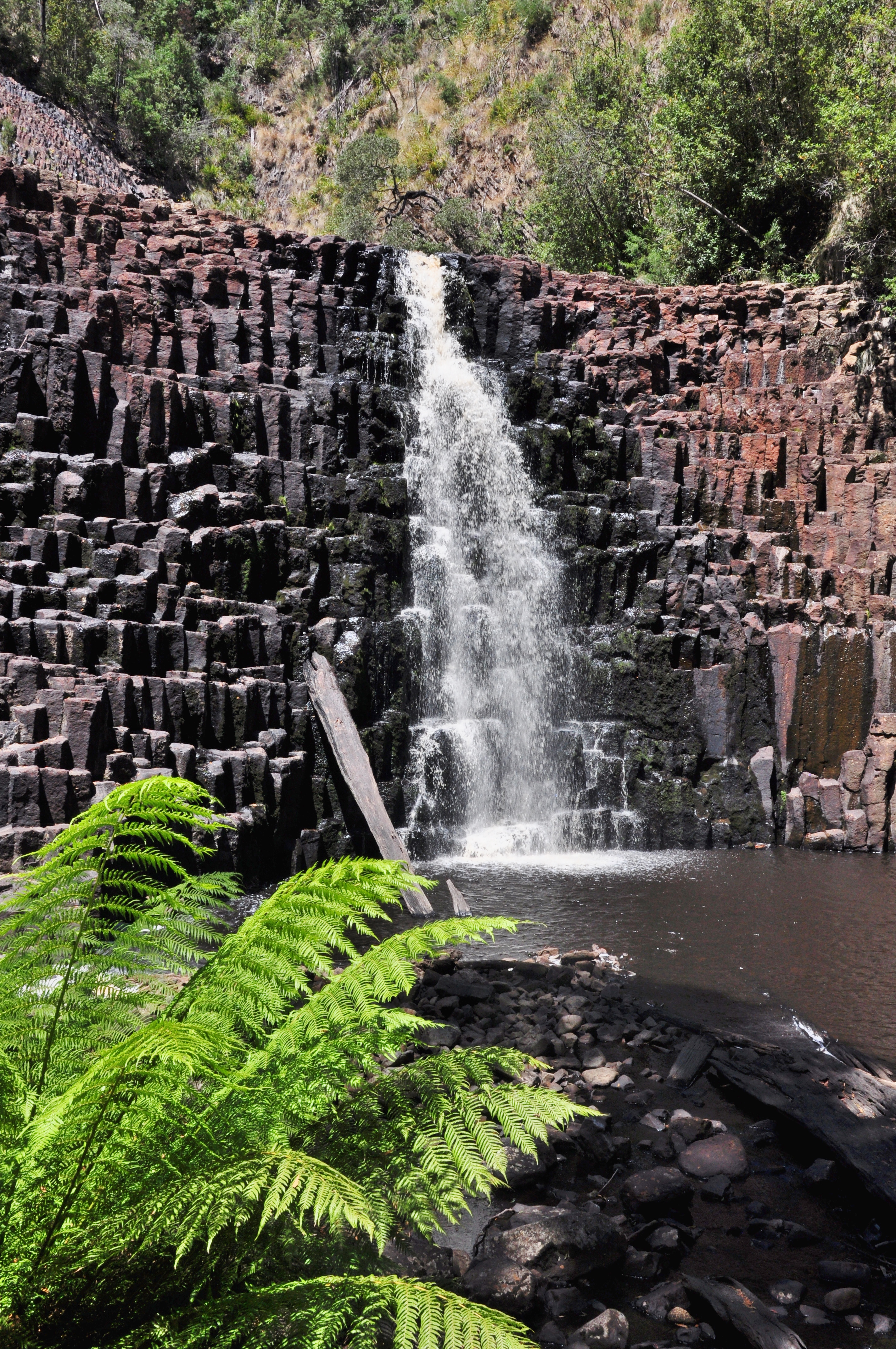
We drove about 40 minutes inland (south) from Stanley along a narrow farm road that is only partially sealed to Dip Falls. It is one of the more interesting of the many waterfalls in Tasmania, mainly because the water flows over cubic-basalt columns.


As for the other waterfalls so far, the water volumn was very low. Despite the lack of water, the falls were still pretty impressive. I can only imagine what these falls look like in spring. The falls are in two distinct sections with a shelf in between. The lower section is far more photogenic,


A short distance further down the road from Dip Falls is 'The Big Tree'. This particular 'Big Tree' is roughly 400 years old & stands at 62m. It is also was a 16m circumference. As for many old growth forests, there's rarely one 'Big Tree' rather a number of similar big old trees, including a few that have falled down.


We chose the Big Tree picnic area to invite the march flies for lunch. Harry's tolerance for the biting flies soon ran out & he finished his lunch in the car.


Stanley and The Nut

The Nut is one of the better known bluffs dotted along Tasmania's north coast. The steep sides of the 143m high extinct volcano are quite dawnting when you are standing at it's foot. There are two ways to reach the flat top.

1. The easy way. Take the chairlift.


2. The hard way. Walk up the steep zig-zag trail.

Stubbornly, we opted for the hard way. I'm going to say that the challenge of the climb was the driving factor. The reality was probably more finacial.

Fortunately, the reward for effort is significant. The unobstructed views from the circuit trail around the rim of the knoll are breathtaking.


There werre plenty of things to see as we made our way around the circuit.


We encountered abundant wildlife including a blue tounged lizard and a family of show-off fairy wrens.


Just as we were admiring the last of the spectacular scenery before decending into Stanley, one more creature decided to impress us with a flying display.

This Autralian Kestrel was hovering completely still in the face of a considerable breeze.

Truth be told, we found decending the steep zig-zag trail more difficult than the climb.

We didn't stop in Stanley itself. There wasn't much of a draw and we had lots still to do.

We did make one stop at the lookout point on the top of the hill that overlooks Stanley before moving on to our next attraction.

Port Latta


This morning we got going early to beat the heat. Today we'd be tracking along the north west coast to one of the mpre famous table top capes, The Nut, along with the historic town of Stanley that shrouds the base of the long extinct volcano.

As we tracked along the coast, we stopped every now and then to enjoy the views back toward Rocky Cape and Table Cape (above). About 20km short of Stanley, we were surprised to find a very long jetty, of all things. As it turns out, Port Latta is home to an iron ore ship loading terminal.

The iron ore is mined near Savage River some 42 kms to the south and piped to the port. Western Tasmania was the last place I expected to find an iron ore mine.

We caught our first good look at the Nut while we were checking out the port.


During one of our photo stops, we left the car unnattended for a moment. Sure enough the crazy rally driver was in the driver's seat as quick as a flash!