Monday 26 May 2008

Northern Lights Wolf Centre & Wapta Falls

The cloud was still hanging around with a bit of drizzle today but it didn't stop us setting off for Yoho.
Right at the border we made a wildlife stop. For the second week in a row, I've seen a Black Bear feeding on the railway tracks. I figured it had something to do with green chutes between the tracks, but I found out today that they are actually eating the spilled grain from the rail cars. With the amount of rail traffic, there must be quite the trail of food on the tracks for the bears. The sad thing is that it lures the bears to the rail only to line them up in front of a train. The bears don't see the trains as a threat and quite often don't move off the track until too late.

Northern Lights Wolf Centre

Today we took the trip out to Golden B.C. (we stayed overnight at Lake Louise). The Northern Lights Wolf Centre is about 10kms to the West of Golden. They have 6 captive wolves at the centre. They were all born in captivity & get exercised/walked without a leash every day. You can even pay $159+tax to go on the walks with them (we may do that later in the year).
Wylie (above & below) is the largest of the males & is very used to people and tends not to hide like some of the others. He seemed very relaxed even with a bunch of people gorking at him.
All the wolves seem to lay around like lazy labradors when there isn't food or a walk in the offering.
Wapta Falls
On the way back from Golden we stopped just inside the western Yoho park boundary at Wapta Falls. It's about a 3km walk to the base of the falls. Unfortunately the weather was against us (as it was all weekend) so the photos didn't come out that well. Its quite the impressive volume of water flowing over the falls, particularly at the moment with the snow melting & a fair amount of rain.
It's just a shame there wasn't a bit more sun. Oh well, you can't win 'em all.

Sunday 25 May 2008

Yoho National Park

This weekend we didn't have much on so booked a hotel room for the night in Lake Louise and set off from Calgary to explore Yoho National Park a bit more thoroughly.
Just on the West side of the Alberta/B.C. border there is a steep hill that runs up from Field to the Alberta border. The incline was way too steep for trains so CP Rail decided to build the  spiral tunnels. I've only ever pulled over at the viewpoint once before & it is very uninteresting without a train in the tunnel. This time we had just gone past a train as we were heading down the hill from the Alberta border. Above & below show the train entering the tunnel at the top of the tunnel.

The photos still aren't that great, but they're kind of interesting none the less. Note that there is only one train in these photos. In the photo below you can see the locos exiting the tunnel while its tail is still entering at the top. This is lower of the two spiral tunnels.
Next on the agenda wasn't new to use but Emerald Lake is one of those places that we like so much that we keep going back. We walked the lake circuit which was pleasant enough but the lake wasn't being particularly photogenic thanks to the cloud cover and an icy breeze.
Signs of summer were appearing everywhere with the plants budding and flowering.
After our walk that was pretty much it for the day so we headed to Banff for dinner before turning in for the night.

Sunday 18 May 2008

Banff National Park Photography

Johnstone Canyon

On Saturday, Kerri was working (well sleeping after night shift) so I took it upon myself to disappear out of the house for the day. The weather had forecast +31 for the day, so I figured a trip into the mountains was on. I needed to have a look around the national parks to check the condition of the trails and lakes. I covered quite a lot of territory in both Banff and Yoho national parks.
Stop 1 was Johnston Canyon along the Bow Valley parkway. We'd been there toward the end of last summer, but I thought it would be a good indicator for the lower parts of the valley. I was hoping there would be some ice on the falls and wasn't disappointed.
There was ice all the way along the stream and around the waterfalls, but none so spectacular as the Upper Falls (below).

Bow Valley Parkway

My next planned stop was Lake Louise. Enroute an extra stop presented itself. This crazy black bear was obviously in need of a snack after winter hibernation. Why he would risk a busy railway line to eat some green chutes is beyond me. 
[Edit] As it turns out they eat the spilled grain from the rail cars and many perish thanks to the busy Rail traffic. I thought I'd be cleaver and show off my "Bear Photo" to the guys at work. My smile was wiped when I got beaten to the punch by Don, who is another keen wildlife photographer. He had been down to Waterton on Friday and took some great pics of a grizzly with her 2 cubs from close range. We were there a week early! Rats! Hopefully Alaska will bring the answers.

The Valley of Ten Peaks

My next stop, Lake Louise, was quite disappointing as the tourist volume was back up to summer numbers, but everything, including the lake, was covered in ice and snow. I took a couple of photos, but they were rubbish like the others I took over winter.
After heading down the hill toward the highway, I took the turnoff to Moraine Lake expecting it to be closed. The signs said closed, but the gate was open and the road ploughed, so off I went, curious as ever. The view as I rounded the last big bend was breath taking (above). The peaks were daunting (the best word I can think of) covered in snow in bright sunshine. I've stopped to look at this same view before, but it never had that effect on me.
The Moraine Lake car park was empty and with the depth of snow on everything, it wasn't surprising. Down at lake level the peaks were even more intimidating.

Yoho National Park.

I ventured over to Yoho National Park to get a feel for where winter was at without much success. Most of the access roads and trails were closed. Natural Bridge was about the only tourist spot open.

Friday 16 May 2008

Sheep River Falls

 Sheep River Falls

This weekend is unofficially the first weekend of the Canadian summer madness. With winter dragging on for nearly 8 months, the sun came out yesterday and we are in for +25 days until Tuesday. Tomorrow's meant to be 31! It's also the first weekend that many of the winter gates open giving access to the myriad of camping sites in the mountains.
Two provincial parks that I've been interested in exploring for the last few months are Sheep River and The Elbow Valley. Parks Canada keep them closed in winter so that the animals have somewhere in the lower valleys to feed without being harassed.

Kerri and I went out exploring today and went right into both parks. Above is Sheep River Falls. It isn't the most spectacular water fall that I've ever seen, but the setting is nice. The front ranges of the Rockies are fantastic at the moment after all the spring snow in the last few weeks.

Elbow Valley

The second park we explored today was the Elbow Valley.
At the very end of the sealed road is Forgetmenot Ponds. I was quite surprised to see how much they were still iced up, but I'm guessing it won't be long before they're defrosted. The water under the ice was the most incredible emerald colour and very clear.
Both Valleys are still looking a bit brown but all the deciduous trees are now budding and I would think that by next weekend, they will all be nice and green again.

Monday 12 May 2008

Waterton Lakes National Park

Today we set out early again to try to find more animals. We were out of luck and the weather had turned nasty again. It was raining in the lake valley showing us a huge rainbow. I couldn't help but take this shot with the Prince of Wales Hotel at the end of the rainbow. After breakfast we headed back to Calgary because with the weather closing in, there wasn't much else we could do. It is a beautiful place and we'll be back in September when we should have a better chance to do the hikes and see the lakes and falls in the park that we didn't this time.

Sunday 11 May 2008

Waterton Lakes National Park

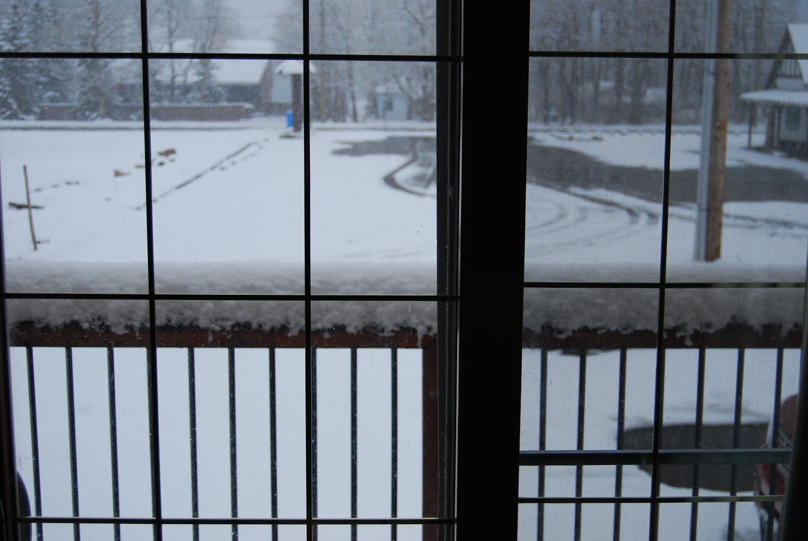
This morning we woke up early and headed out to try to find some more animals. We had hoped to drive out along one of the Parkways, but they were still closed. We had no option but to drive out toward the park gate. It's quite a nice drive and we'd had seen the sheep and deer along with elk while driving along it the previous afternoon. Oddly enough, we didn't see any animals except for the deer in the township. That was until I spotted something on other side of lake. It was completely unexpected but it was a pack of either wolves or coyotes. Excitedly I thought they were a pack of wolves but, having studies the photos, I think they were a small family of coyotes. They were the best part of a kilometre away so it is a bit hard to tell.

Bison Paddock

After breakfast We returned to the Bison Paddock on the way to Red Rock Canyon and were lucky enough to see a couple of bulls up reasonably close. We couldn't drive inside the paddock because it was still closed but got close enough from the perimeter road to get a few photos.

Red Rock Canyon

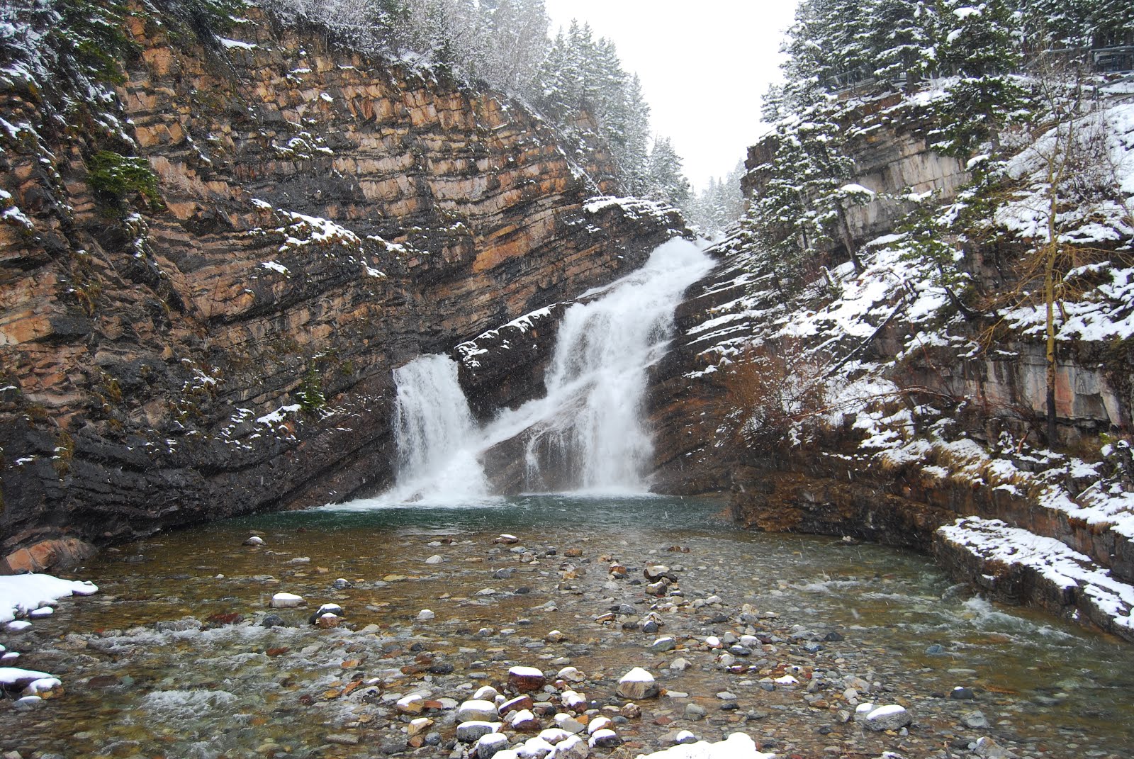
We were hoping the parks people had opened the 2 parkways. To our relief, some were and we set out along the Red Rock Parkway. We didn't see any animals and the meadows were still buried under nearly a foot of snow. We reached the end of the road, Red Rock Canyon.
 
 
It was a bit hard to understand the name when it was buried under snow, but we got the idea. There's a short loop walk that runs alongside the canyon. Unfortunately the snow and overcast conditions took the edge off it. It was still interesting enough.
 
Just when we were about to cross the bridge over the canyon we spotted paw prints.
 
A grizzly bear had crossed the bridge a within hours of our presence. It had to have been sometime after the snow had stopped because there was no fresh snow in the prints. At a guess it was early that morning.
 
I'm told the way to tell a grizzly print from a black bear's is the claw marks. The Black bears claws retract. Check out the size comparison with Kerri's foot. I'm not sure that an encounter with this one would have been a good idea.
 
After the excitement with the bear tracks, we started to hike to Blackiston Falls on the other side of the valley in the shadow of Mt Anderson (above). The trail was deep in snow & we kept breaking through the top crust and ending up knee deep in white stuff. We ended up turning not even half way to the falls because it was way too dangerous. As it was Kerri nearly twisted her knee a couple of times.

Cameron Creek

 
So we hopped back in the car and headed along the Akamina Parkway beside Cameron Creek (above) hoping to end up a Cameron Lake. Unfortunately the road closed just before an avalanche zone about 2 kms short of the lake so we turned around and ended up back at township.

Bertha Falls

We were getting frustrated by this point and executed Plan C. It was a 2.8km hike to Bertha Falls (below). The trail was covered in a foot of snow, but not as bad as the one to Blackiston Falls. By the time we headed back, the trail was slushy and wet. Our shoes we soaked but it was just about worth it.
 
 
By the time we arrived back in town, most of the snow had melted off exposing the spring grass. It suddenly dawned on us why we'd seen so many animals down in the township. With the higher elevations still covered in snow and with few humans to hassle them, the grazers had a nice supply of fresh green grass to munch on. A mob of bighorns had set up camp right outside the visitor centre.

 Red Rock Canyon

Later in the afternoon we drove out along the Red Rock Parkway hoping to see animals again. It was amazing to see the foot of snow from the morning, completely gone! It became obvious where the canyon got its name.
Returning to town, just before we were about to give up on animal spotting we spotted a deer with it's white tail up in alarm.
 
On closer inspection we saw two coyotes eating a carcass.We followed one of them a little way along the tree line and beside a pond. Unfortunately we hadn't packed the tripod and the photos ended up a bit fuzzy.
 
It was fantastic to see these ultimate scavengers up close. The locals (particularly the farmers) hate them, but I happen to think they're great.

Saturday 10 May 2008

Waterton Lakes National Park

 
Waterton Lakes National Park sits in the south western corner of Alberta. It isn't one of the well known mountain parks further to the north and benefits from the lack of tourist buses. The park shares boundaries with Akamina-Kishina Provincial Park (British Columbia) and Glacier National Park in Montana (USA).
We booked a weekend in Waterton some months ago figuring that by May there would be some weather that resembled spring. I guess we underestimated the power of winter in these parts. It was the first time the weather didn't play nice for one of our North American holidays. It snowed most of last night and the roads were treacherous on the way down. The further south we traveled, the worse the conditions became. First it was rain, then sleet at one time and by the time we reached Pincher Creek, some 200 kms south of Calgary, it was snowing. The roads south of Pincher creek were awful. Unfortunately, I'd only changed out the winter tires for hard compound summers last Monday making the snow even more difficult to negotiate.
By the time we arrived in Waterton there was a foot of snow on the ground. We checked into the hotel and looked out to a bleak site. What had we done?
We drove around the town during the afternoon while it was bucketing down with snow. There were Mule deer everywhere. Interestingly they were only the mums with their fawns. The confused ground squirrels were popping their heads out of the snow wondering why spring had deserted them already. We stopped at Cameron Falls (below) which is just on the edge of the town.
After exploring the township, we ventured back along the access road into the township. At least it wasn't snowing so much anymore. There was a hillside just out of town where a mob of about 30 Big Horn Sheep were digging through the snow for grasses. A small heard of mule deer were mixed in as well.
 
It was awesome to be able to see them up close.
 
 
The animals didn't even seem to acknowledge that we were even there.
The snow stopped about 5pm so we took the opportunity to have a look around while we could see more than 10ft in front of us. As it turned out, the weather was calm after the snow storm which meant the Waterton Lakes were like a mirror. The mountains at the far end of the lake are in fact in Montana. Upper Waterton Lake (above) actually extends quite far into Montana. The mountains in the background are in fact in the USA. Also in picture is the Wateron township across the lake (to the right of the picture).
The Prince of Wales Hotel.
I think its location makes it more famous than anything. It's pretty hard to miss. The architecture is quite interesting as well. It's flagged as a 5 star hotel and judging by the nightly rates, you pay for the rating. Oddly enough, it's only open during summer.


There are two roads that lead into the main park, The Red Rock Parkway & the Akamina Parkway. Unfortunately both parkways were closed thanks to the snow so we headed just out of the park to the Bison Paddock. It's just a big fenced off paddock where they have a small heard of Bison. Unfortunately the animals were a long way off & the photos weren't great. Maybe we will more fortunate when we go back tomorrow.