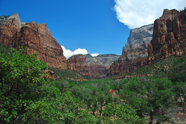
The road accessible part of Zion is quite small yet it's very popular with tourists. Some years ago the National Parks people decided to close the roads to private vehicles and started a free bus service to cut down the traffic in the park. It works really well, because the buses stop at every point of interest or hiking trail head in the southern section of the park. All you do is park your car in the car park and hop on the buses for the day. Apparently the animals have since returned to the park and the CO2 levels have dropped as well. The Americans aren't renowned for their environmental conservation, but in this case it's a master stroke. In my case, I was already starting to get sick of driving so taking the day off and sitting on a bus here and there was a welcome change.
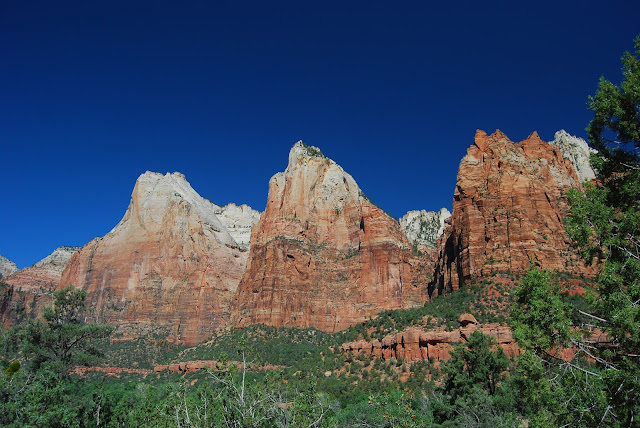
The Court of the Patriarchs
Our first lookout point was the Court of the Patriarchs. You'll notice from the photo above in particular that the top of the peaks are white and the lower rock layers are a deep red. It's pretty typical pattern for southern Utah and is as a result of the differing history of the area. Originally most of North America was a shallow ocean then as the tectonic plates moved around and collided with each other. It ended up being a huge plateau well over a 1000m above sea level.The small river that cut this beautiful valley has created some incredible scenery. Above is the relatively (when compared with the Colorado River) small stream that has cut the Zion Valley. As a comparison, the Grand Canyon is roughly 1 mile (1.6kms) deep. The peaks above this little stream tower over a kilometre above us! It's quite the place.
Saddle Back
The red rock in the middle foreground is called Saddle Back. It's popular with hikers that like a bit of adventure. Directly behind it is the Great White Throne.Emerald Pools
Our first short hike for the day was to the Emerald Pools. There are three pools in all. Lower, Middle and Upper Emerald pools. They're very imaginative with their names in America. The Middle Pools (below) run off a 10m cliff forming the waterfall above dropping into the Lower pool.The pools themselves aren't that interesting, but the settings are pretty nice, particularly the Upper Pool (above) that has an incredible cliff face that towers above it (below).
The Weeping Rock
The Weeping Rock is another of the garden water features of the park. The water filters through the rock layers and falls off this ledge 100s of years later.
The River Walk
We messed up at Zion. Despite some good advice, I had thought that Emerald Pools was a "Must Do" but in fact it was the River Walk. By the time we got to it, the temperature was nudging 40C, we were all a bit dehydrated and some a bit sun burnt. Time was also our enemy as we had to see the northern section of the park on the way to Cedar City. We did go part the way along the path to the point where the path stops and the stream becomes the path. Considering how hot the ambient temperature was, the water was incredibly cold.Virgin, UT
This oddity is something of a tourist attraction just outside the entrance of the main part of Zion Nation Park. It's odd to the point of being creepy.Toquerville, UT
Yet another SW Utah anomaly. This is the rare North American Shoe Tree. This particular specimen is just near the town of Toquerville Utah. You've got to wonder who starts these things.
Kolob Canyon
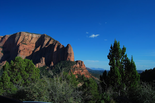
The north western part of Zion has a road that the public can drive all the way along, but rarely do. We reached Kolob Canyon late in the day and found it to be just as good as the main (southern) part of the park with less people.Above and below makes up part of the view from the far end of the Kolob Canyon Road. We stayed for quiet some time to take in the view. It topped off a fantastic, if hot, day. I'd love to come back some day in the cooler months, do a few hikes and explore some more. What a great place!


