
South America Day 11
I woke up still a little dodgy, but much better which was fortunate because we were about to start a 3 day hiking expedition.Our first stop was the small town of Calca and the local markets for supplies. Calca is the gateway to the road to Lares (the start of our hike). The markets would allow us to buy toys and stuff for the children along our hike. For me, it was more about finding an inner sole for my recently repaired hiking boot. I was sent off with the assistant guide, Jose', who managed to find one nice and quick.
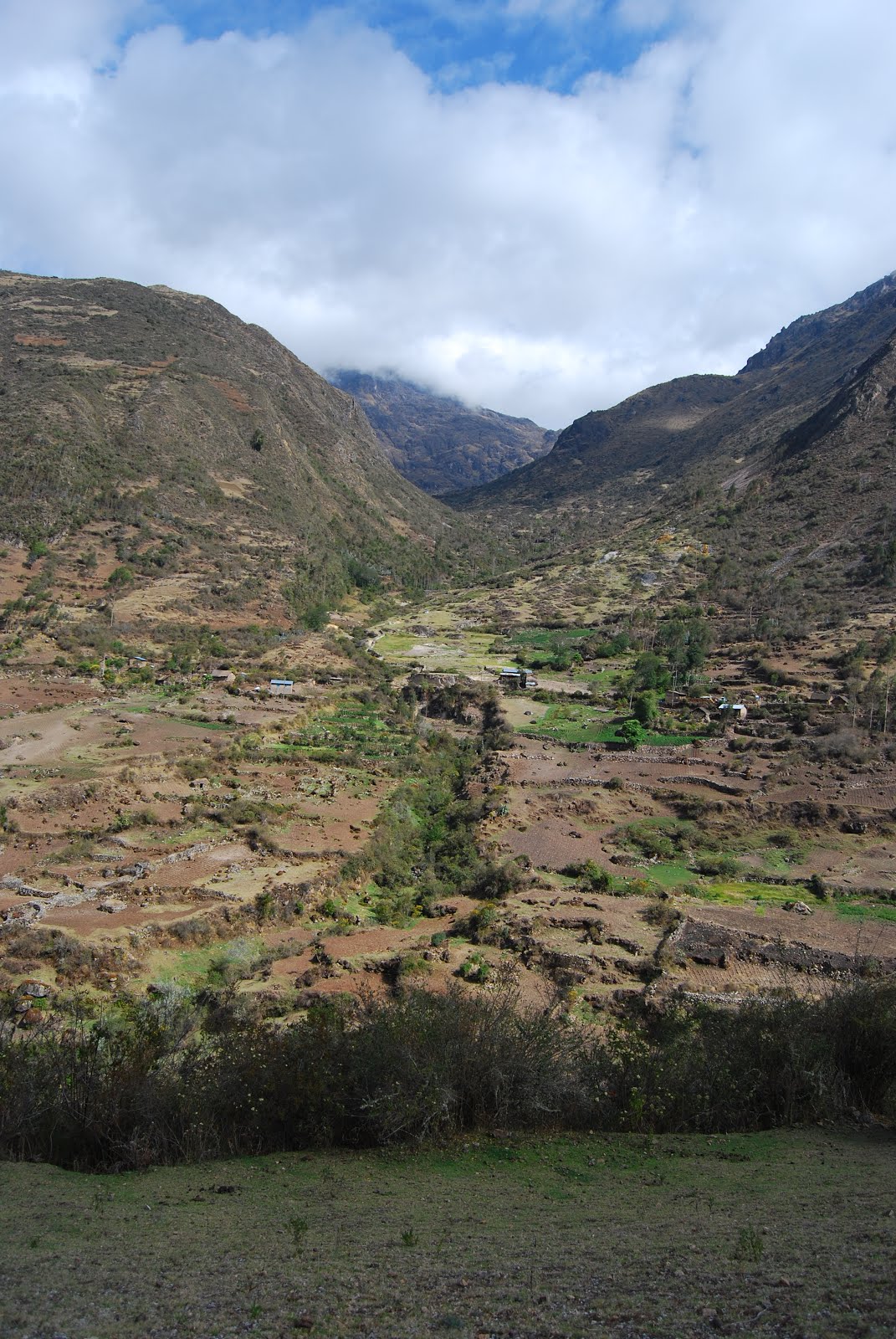
The road to Lares was long and windy. The photo above was taken from the high point as we crossed the ridge. I saw a condor briefly which was all very interesting, but the trip was still a bit tedious. The scenery was interesting enough.

The start of the trek was the hot springs just outside Lares.
You can see the buildings in the background of the shot above. We got done
big time by the guides (it was to become a pattern). We had nowhere to
stop for "relief" along to long drive from Calca and with a bus full
of girls, there was some desperation involved. The issue was that the
only place to relieve ourselves was at the hot springs complex which
cost quite a bit to enter regardless of whether we wanted to use the
baths or not. Turns out the springs were a disgusting milky brown colour and the locals seemed to have come to wash themselves in them. It
wasn't at all inviting.
Never the less the cooks/porters cooked us up a nice lunch and we set off from the back of the hot springs complex across the bridge in picture. Again an opportunity for a group shot. This one had the entire clan but the shot at the end of the trek looked a little different.
Never the less the cooks/porters cooked us up a nice lunch and we set off from the back of the hot springs complex across the bridge in picture. Again an opportunity for a group shot. This one had the entire clan but the shot at the end of the trek looked a little different.

We set off up the Lares Valley toward our first camp. It wasn't that
difficult to start with as it was a fairly gentle incline. The hike in
Colca Canyon some days earlier was harder. It was quite pleasant
wandering beside the small stream.

Despite the easy going, we still seemed to spend a lot of time stopping and waiting for stragglers (this was the first). Special K was the
first casualty and started the "I didn't sign up for this" saga.
Actually she did sign up for this because it was pretty clear in the GAP
trip description and difficulty rating. There we a few others that
were finding it difficult while some of us were wondering how this was
going to play out over the next few days.
Above is the view of the opposite side of the valley at our first rest stop.
Although the incline wasn't too extreme, we'd been steadily gaining
elevation.


Along the way there was no shortage of birds including this little
humming bird. The purple flowers are apparently used a lot by the locals
as a clothing dye.

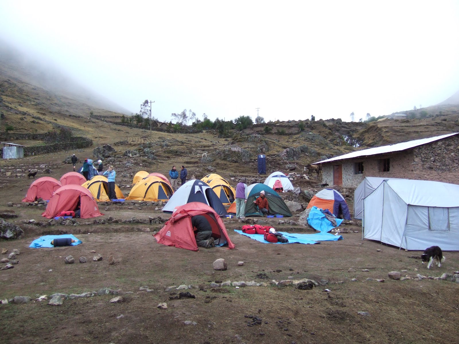
Base Camp 1
We continued up the valley into the fading light at the end of the day. The stragglers were left behind with the trailing guide. As the light faded, the temperature dropped sharply and our core temperatures went with it. I thought I was getting a bit of a pinched nerve in my right arm from carrying the back pack and camera, but it turned out to be circulation.As we reached the camp at Wakawasi we realized the porters and the mules had beaten us there. The tents were all pitched and dinner was in progress. My cold arm was more of a problem than I first thought and it took half an hour curled up in the sleeping bag to bring it back to normal. I've got to say I was worried for quite some time. Mental note for the next day to make sure I have warm gloves.


